As many of you know, I took a long-awaited trip to Newfoundland a few weeks ago. It was on my bucket list and the only province in Canada that I’d not yet visited – the Territories still await.
In A Beautiful Anarchy, David duChemin writes:
“There is room to live our lives increasingly on our terms, as engaged and intentional as possible, as creatively as possible, with the freedom to follow the muse, or our own curiosity, down the road that’s unique to us.”
He advises not to wait until it’s too late. This is what I’ve been trying to do in the past few years, with my business and my life.
Decide what’s most important and do that.
Last year, I visited the Palouse region of Washington/Idaho (also on my desired places list) and discovered a magical place. This year it was Newfoundland. And, I’m so glad I went.
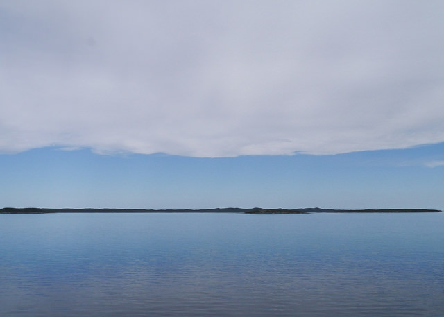
After a trip I like to look at my images as a whole, identifying any themes that emerge. It’s a way of clarifying the essence of the place for me. Patricia Turner (A Photographic Sage) recommends finding “your icon of experience”; the one image that sums it all up. Mine begins this post.
Newfoundland is an island and water provides the container for everything, it seems. Fishing and boating are a huge part of people’s lives, so often their view is from the boat, not the land. This image was taken from the Fogo Island Ferry, on a beautiful day where water meets land meets sky meets clouds. It’s simplicity reflected the place. Below are a few more of my favourite pictures from the trip and what they say about this rugged, beautiful place.
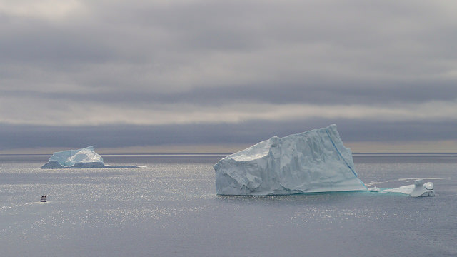
A Banner Year for Icebergs
We’d heard it was a banner year for icebergs in Newfoundland, but there’s nothing like seeing the real thing. This image was taken from Fort Amherst in St. John’s on a cool, cloudy day with the sun peeking through every once in awhile, creating the sparkling water. Every day we saw icebergs in new locations and it never got old. As a matter of fact, they seemed more spectacular every time we saw them.
On the last day, we were in Twillingate (also known as Iceberg Alley). This area is where the icebergs drift from Greenland and are drawn into the coves. We got to see them up close and personal there. People have asked me what the highlight of the trip was – and it was definitely icebergs.
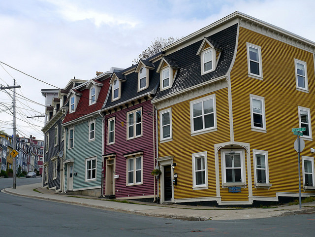
Jellybean Row
St. John’s is the capitol of Newfoundland and it’s known for Jellybean Row – colourful Victorian row houses. According to this article, a downtown revitalization project dating from 1977 led to this phenomenon. The homes on one street were painted in the bright colours and it was a big hit. Eventually, other blocks followed suit.
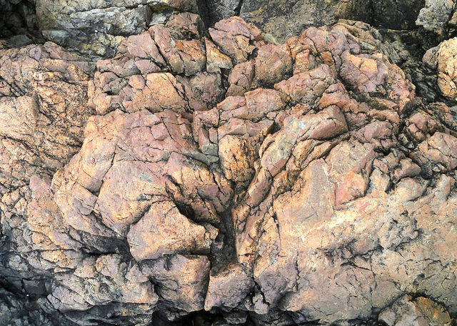
Island of Rock
Newfoundland is an island of rock; many areas are reminiscent of Ireland. I took many, many images of the different rock surfaces I encountered. The one above reminds me of a flower blooming and lit up.
Our first four days were spent in the Avalon zone on the east coast, where the rock is described as follows – marine sedimentary rock, including unseparated limestone and volcanic rocks. Fogo Island is composed of mostly granite, and Twillingate (another island) is made up of volcanic and sedimentary rock. Here is a geological map of Newfoundland.
Water and Fishing Villages
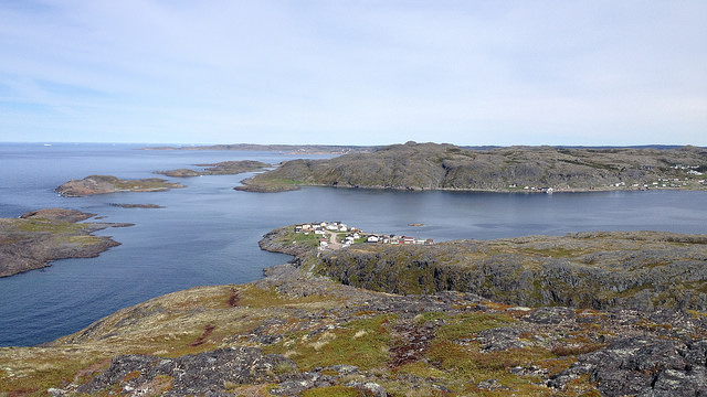
This is the view from the Fogo Head Trail, overlooking the town of Fogo. It shows the incredible landscape of inlets, coves, and small islands, and how everything is tied to the water (the Atlantic Ocean). This trail is near Brimstone Head, considered to be one of the four corners of the earth by the Flat Earth Society. We often did feel like we were at the edge of the earth. Cape Spear, near St. John’s is the easternmost point in North America. Next stop – Ireland.
Jagged Edges
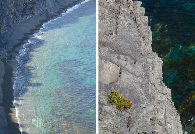
Jagged edges were something I noticed throughout our stay. We found ourselves often on the edges of dangerously high cliffs (like the image above right) – pretty exhilarating. The Atlantic Ocean creates many coves and I noticed how the ocean surf also created a jagged edge as it came into shore.
Fogo Island
“Fogo Island is a barren landscape of marsh, scrub and lichen-mottled boulders, expansive and fog-soaked, at the edge of the continent.” – Lisa Moore, Rock Haven
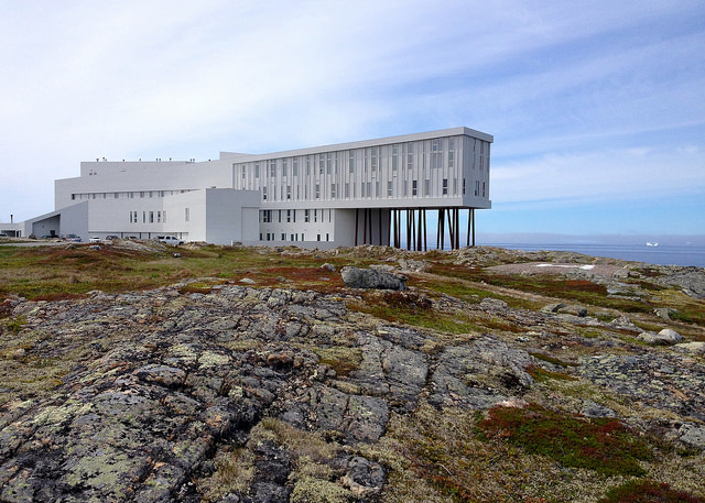
Fogo Island consists of several small towns. We stayed in Joe Batt’s Arm at the Quintal House B&B (highly recommended). But this small fishing village is also home to the unusual structure below, The Fogo Island Inn.
The story behind this inn is unusual in itself. You can read more about its beginnings from this New York Times article – The Possibility of an Island. We had an amazing dinner (supper) at the Inn. It’s well worth a visit.
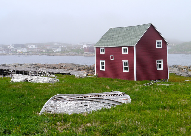
While on Fogo Island, we also visited the nearby town of Tilting (including an old Irish cemetery) on a cold and foggy day. The fog showed off the old fishing boats, rocks, and red stages (where fish are processed, salted and dried).
The Skerwink Trail
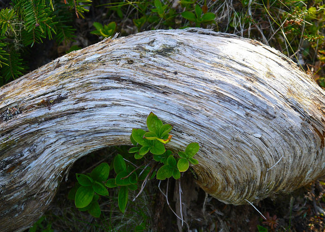
Driftwood was another common scene and I loved the sensuous curves of this piece seen on the fabulous Skerwink Trail in Trinity – one of the top hikes in the world for its scenic views.
I hope you enjoyed my visual tour of the rugged beauty of Newfoundland. My friend, Norah, who went on the trip with me and another friend, wrote a poem about the experience, What Newfoundland Says.
Do you have a place you’ve always wanted to visit?
Such gorgeous shots of your time in Newfoundland. I love those coloured houses too and the aqua blue-green water you have captured.
Deciding what’s most important and then doing that without delay. Well, yes, in theory that’s a wonderful idea! Travelling is possible when one has the means! So I do small things near to home and also within the home and my travelling happens within!
Thanks for your comment, Sandra. I was eager to share my photos of Newfoundland because they meant so much to me.
Travel is important to me, but not all the time. For me, it’s certain places that I want to make sure I visit. And, travel isn’t for everyone. Deciding what’s important is the key and letting the rest go, just as in our simplicity class. And, not necessarily without delay, but at least start the planning. How will I make this happen if it’s so important to me?
David duChemin writes about this in A Beautiful Anarchy. He lives as a nomad, not owning a house or many material possessions. He camps in some of the most beautiful places on earth. Travelling is more important to him than owning a home.
My daughter travelled around the world on a shoestring. When her friends say that they wish they could do that, she tells them that if she could, they can too.
While we have to live within some limitations or obligations, we often have way more choices than we can imagine. That’s my theory, anyways.
Oh these are just magnificent, Kim! I’ve been to Newfoundland (BC – before camera) and you have really captured what I remember — and so well. I love all of these but my faves have to be the Island of Rock and Jagged Edges. Quite powerful! It is obvious how much you loved the place. I couldn’t agree more with your point about deciding what is important and doing that. I do love to travel and I have more than one place that I’ve always wanted to visit so I won’t list them all here. And while I’m sure I will get to some of them, I also jump at any opportunities that present themselves, even if they aren’t on my list. Because anywhere can be fabulous with the right approach. And I totally agree that we often have way more choices that we imagine. I’m so glad that you had such a wonderful experience this summer.
What an amazing opportunity for you – to experience this wondrous place with camera in hand. Your photo collection captures the beautiful breadth of this place – yet all “contained”, as you said, by water. Your “icon” photo is so wondrous in its simplicity – big water, big sky and such a tiny sliver of land. Breathtaking!
This place is also on my “To Visit…” list, Kim. I was stunned by the raw beauty of your images and also how the pink variegated rocks look so similar to the ones I saw on the Isle of Staffa! I love your “icon of the experience” too!
Thank you, Spending a morning contemplating my creativity & my photography & reading this post & watching your video (LOVE!)… things are starting to click for me. So grateful I found you!
Very happy to hear that, Regina!